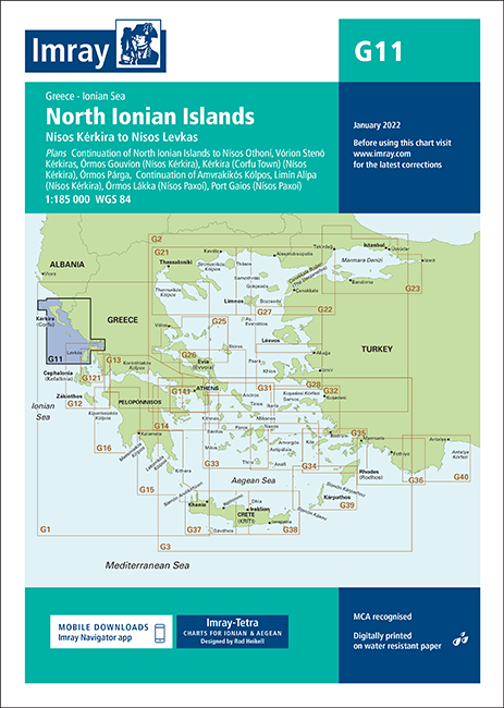
Imray Chart G11 “North Ionian Islands”
37.10€
Imray-Tetra charts for the Ionian and Aegean are widely acknowledged as the best available for the cruising sailor.
Οι χάρτες Imray-Tetra για το Ιόνιο και το Αιγαίο αναγνωρίζονται ευρέως ως οι καλύτεροι διαθέσιμοι για τους ναυτικούς.
Plans included:
Continuation of North Ionian Islands to Nisís Othoní (1:185 000)
Vórion Stenó Kérkiras (1:70 000)
Órmos Gouvíon (Nísos Kérkira) (1:25 000)
Kérkira (Corfu Town) (Nísos Kérkira) (1:25 000)
Órmos Párga (1:10 000)
Continuation of Amvrakikós Kólpos (1:185 000)
Limín Alípa (Nísos Kérkira) (1:10 000)
Órmos Lákka (Nísos Paxoí) (1:7500)
Port Gaios (Nísos Paxoí) (1:10 000)
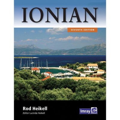
Imray-Tetra charts for the Ionian and Aegean are widely acknowledged as the best available for the cruising sailor. They combine the latest official survey Digital with first-hand information gathered by Rod and Lucinda Heikell. The chart is designed to be used alongside Imray pilot guides of the area.
Like all Imray charts, they are printed on water resistant Pretex paper for durability, and they include many anchorages, facilities and inlets not included on official charts. This edition includes the latest official Digital combined with additional information sourced from Imray’s network to make it ideal for small craft. It includes the latest official bathymetric surveys. There has been general updating throughout.
Συμπεριλαμβάνει:
Συνέχεια Βορείου Ιονίου προς Νήσιους Οθωνούς (1:185 000)
Vórion Stenó Kérkiras (1:70 000)
Όρμος Γουβιών (Νήσος Κέρκυρα) (1:25 000)
Κέρκυρα (Πόλη της Κέρκυρας) (Νήσος Κέρκυρα) (1:25 000)
Όρμος Πάργας (1:10 000)
Συνέχεια Αμβρακικού Κόλπου (1:185 000)
Limín Alípa (Nísos Kérkira) (1:10 000)
Όρμος Λάκκα (Νήσος Παξοί) (1:7500)
Λιμάνι Γάιου (Νήσος Παξοί) (1:10 000)
Οι χάρτες Imray-Tetra για το Ιόνιο και το Αιγαίο αναγνωρίζονται ευρέως ως οι καλύτεροι διαθέσιμοι για τους ναυτικούς. Συνδυάζουν την τελευταία επίσημη έρευνα Digital με πληροφορίες από πρώτο χέρι που συγκεντρώθηκαν από τους Rod και Lucinda Heikell. Το διάγραμμα έχει σχεδιαστεί για να χρησιμοποιείται παράλληλα με τους πιλότους οδηγούς Imray της περιοχής.
Όπως όλα τα γραφήματα Imray, είναι τυπωμένα σε αδιάβροχο χαρτί Pretex για ανθεκτικότητα και περιλαμβάνουν πολλές αγκυρώσεις, εγκαταστάσεις και εισόδους που δεν περιλαμβάνονται σε επίσημους πίνακες. Αυτή η έκδοση περιλαμβάνει το πιο πρόσφατο επίσημο Digital σε συνδυασμό με πρόσθετες πληροφορίες που προέρχονται από το δίκτυο του Imray για να το κάνουν ιδανικό για μικρά σκάφη. Περιλαμβάνει τις τελευταίες επίσημες βαθυμετρικές έρευνες. Υπήρξε γενική ενημέρωση σε όλη τη διάρκεια.


